LOUISIANA DEPARTMENT OF TRANSPORTATION AND DEVELOPMENT
Mapping out the future for bustling Baton Rouge
The Baton Rouge Metro Area has grown from one parish and 158,000 people in 1950 to nine parishes with a population in excess of 800,000 today. With such rapid growth in this vibrant capital city that is home to Louisiana’s largest university, developing a Long Range Transportation plan was extremely important to the development of the area.
When the Louisiana Department of Transportation and Development (LaDOTD) needed to update that plan, it immediately sought out Neel-Schaffer to conduct the study, in large part because of Neel-Schaffer’s long-standing relationship with the LaDOTD and familiarity with the Metropolitan Planning Organization (MPO). The plan study area was limited to Baton Rouge MPO’s planning area, which includes all of East Baton Rouge and portions of West Baton Rouge, Ascension, Livingston and Iberville parishes.
Jerry Trumps, Neel-Schaffer’s Southwest Area Manager, believes this plan will have a lasting impact on the Baton Rouge urbanized area. “This plan will guide the state and local governments in planning future funding and implementation of projects in the next 25 years that will have a positive and significant impact on the Capital Region based on future growth,” Trumps said.
The Long Range Metropolitan Transportation Plan (MTP) is a blueprint to guide the development of programs and transportation projects within the Baton Rouge urbanized area. The vision that drives the process of creating the MTP is locally developed and caters to the needs and future of the urbanized area.
Neel-Schaffer was able to incorporate the following in this particular project:
- Network and demographic data collection
- Update street and highway network
- Development of a time-of-day travel demand model
- Forecast for the year 2037 socio-economic data
- Forecast for the year 2037 traffic volumes
- Development of a Truck Model using Quick Response Freight Manual procedures for both medium and combination trucks
- Testing for various street and highway networks to evaluate the impact of alternative improvements on expected locations of capacity deficiencies
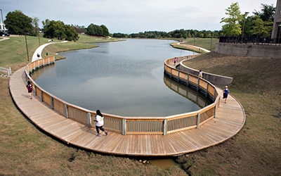
- Development of bike and pedestrian areas
- Conduct model runs and compile input data required for Air Quality Conformity Analysis
- Development of an updated scenario manager to run the model using TransCAD’s GISDK scripts
Neel-Schaffer completed what was scheduled as an 18-month project in only 12 months to facilitate air quality conformity analysis and the development of conformity report. Using generally accepted transportation procedures and computer modeling techniques, our planners prepared a high-quality color summary brochure for public distribution, created a detailed report documenting the modeling process, created an alternative analysis, and prepared a recommended plan. Overall, the project cost was $710,000.

