


BATON ROUGE, LA
Planning for the future for Louisiana’s capital city
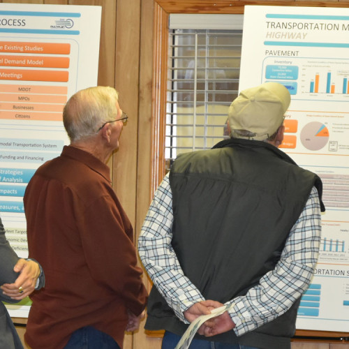
Neel-Schaffer was selected by the Louisiana Department of Transportation and Development (LADOTD) to conduct this study for the purpose of updating the Long Range Transportation Plan for the Baton Rouge Metropolitan Area.
TransCAD modeling software was used to conduct this study, and a MAP-21 compliant transportation plan was developed.
Generally accepted transportation planning procedures and computer modeling techniques were used in this study. A high quality color summary brochure was prepared for public distribution. A detailed report documenting the modeling process, the alternatives analysis and the recommended plan was also produced.
The project included the following tasks:
- Network and demographic data collection
- Update the street and highway network
- Develop a time-of-day travel demand model
- Calibrate and validate the 2010 Base Year Model to replicate actual ground counts within acceptable levels of accuracy
- Forecast year 2037 socio-economic data
- Forecast year 2037 traffic volumes Develop a Truck Model using Quick Response Freight Manual procedures for both medium and combination trucks
- Test various street and highway networks to evaluate the impact of alternative improvements on expected locations of capacity deficiencies
- Develop Safety, Security and Environmental Mitigation analysis plan elements Develop bike and pedestrian elements
- Conduct financial analysis of transportation system revenues and costs
- Develop a Recommended Transportation Plan from the analysis of the test networks
- Develop a financially constrained stage improvement program
- Conduct model runs and compile input data required for Air Quality Conformity Analysis
- Develop an updated scenario manager to run the model using TransCAD’s GISDK scripts
- Provide training to CRPC staff